Natural Resources Management

CEGIS has highly dedicated multi-disciplinary qualified professionals who provide well informed and sound technical solutions based on accurate data supported by a rich database and reliable mapping prepared extensively using space technology and GIS. In resource and environmental analysis, it uses analytical tools like water modeling, salinity intrusion modeling, fisheries resources assessment modeling, regional basin modeling, digital terrain/digital elevation model, crop model etc. The areas where considerable expertise and excellence and have been developed are:

  • Master Planning
  • Feasibility Studies
  • Land Management
  • Water Resources and Planning and Development
  • Agricultural Planning
  • Economic Planning
  • Energy Management
  • Urban Planning

Wind Mills in coastal areas of Bangladesh

Wind supplies high-quality, clean and environment-friendly energy services. To facilitate further actions, an extensive study on wind power feasibility has been done in different parts of Bangladesh to choose the best possible options for different scale wind power mills.

River Management

CEGIS is a unique organization that examines river, delta, coastal, and estuary dynamics and morphology-based on spatial and hydro morphological data, and applies geospatial technology to the river, delta, and coastal management concerns. It monitors and predicts the extremely high rate of year-round variability of water and sediment flows, erosion-deposition, channel shifting or abandonment, bar formation, delta shifting, and progradation and intends to determine the geomorphological evolution of Bangladesh delta on a decade-to-century scale. CEGIS predicts riverbank erosion in Bangladesh's major rivers using an innovative technique created to stabilize river courses. It is also involved in the planning, design, and monitoring of optimum dredging for maintaining navigation in Bangladesh's various navigation and ferry routes, as well as port approaches, using scientific methodologies. It also conducts morphological analyses on river crossing constructions such as bridges, culverts, rail, and transmission lines.

  • Development of a tool for predicting riverbank erosion
  • Development of a novel approach for optimizing and monitoring dredging for improved navigation routes
  • Different dredging guidelines for different regions
  • Automation of dredged volume quantification
  • Selection of bridge and transmission line locations
  • Assessment of the impact of climate change on river and estuary morphology
  • Prediction of Coastal Morphology
  • Model on the evolution of rivers in the haor areas
  • Model on delta development

River Bank Protection

Riverbank restoration and stabilization require concrete revetment structures to provide lateral and vertical stability along the eroded banks.

Geoinformatics and Spatial Technology

Geoinformatics and spatial technology support policymakers to ensure sustainable project planning based on the spatial relationship between major interventions. In the context of Bangladesh, at present, the government emphasizes applying geospatial technology and solutions in the project formulation to implementation stage. CEGIS provides highly adaptable and customized solutions through GIS (2D/3D) map production, Data digitization and management, Satellite imagery analysis, GIS web and app development, Custom cartography, GIS modelling and analytics, Survey and data collection etc. It renders diversified and comprehensive geospatial support for a wide range of disciplines including but not limited to the environment, water, agricultural, energy, and communications sectors by combining remote sensing technology with Geographic Information Systems (GIS). CEGIS’s GIS team is trained and has a wide knowledge of the latest geospatial technology such as Big data handling, Spatial analysis, Cartography, GIS-based modelling and other vibrant GIS solutions. Using space technology and GIS tools, it provides the services namely:

  • Digital mapping and real-time database development for utility services such as gas, electricity and road network
  • Land use and land cover mapping and change detection
  • Develop clutter data and vector-based 3D building model for telecommunication
  • Disaster monitoring and damage assessment in Near Real-Time (NRT) mode
  • Digital Elevation Model development from various source of data
  • Prepare GIS-based Land Ownership Database for land acquisition and resettlement planning
  • Multi hazard and vulnerability mapping and disaster risk assessment
  • Develop GIS-enabled web mapping, geospatial solution for Decision Support System
  • End-to-end Enterprise GIS solutions. CEGIS staff is highly capable of systems architecture, database design, implementation as well as integration with other complementary systems. An enterprise GIS allows clients to view and edit GIS data through easy to use web and mobile applications. Topographic survey using latest and finest technology.

Hazrat Shahjalal International Airport in Satellite Image

High-resolution satellite image for spatial analysis

Disaster and Risk Management

CEGIS is contributing to achieving sustainable development goals (SDGs) through Disaster Risk Reduction and its management. It provides services for flood and erosion monitoring, river and coastline shifting, flood extent assessment, coastal water logging, community and ICT-based early warning and dissemination system, disaster risk mapping, disaster preparedness related strategy development, risk recovery mechanism development and climate change monitoring etc. CEGIS created disaster risk reduction (DRR) training and capacity-building modules for government and non-government officials, researchers, students, and community members. It collaborates closely on disaster risk management concerns with government and non-government institutions, donors, development partners, and international partners. CEGIS has acquired expertise in multi-hazard zone mapping based on community risk assessment (CRA) for local disaster management. CEGIS makes great use of space technology, analytical tools, and its enormous database to complete these tasks. Following are noteworthy areas of expertise of CEGIS for disaster and risk management:

  • Preparing action plan for disaster preparedness and risk reduction
  • Strategy development for Eco-DRR
  • Disaster risk and vulnerability assessment using scientific and participatory tool
  • Disaster risk mitigation
  • Community-based risk assessment and participatory scenario development
  • Assessment of risk reduction need and risk recovery mechanism
  • Development of early warning system and information management system
  • Capacity development of stakeholders and community for DRR
  • Post-disaster rehabilitation and recovery
  • Pre and post-disaster WASH technologies development
  • Landslides and lightning risk management

Flood in Haor Areas

Rivers exceed the capacity of the natural or constructed channels to accommodate the flow, water overflows the stream banks, spilling out into adjacent low-lying areas.

Climate Change

CEGIS is a pioneer in delivering versatile climate services using the latest tools and techniques acknowledged and recommended by IPCC and UNFCCC. CEGIS conducts downscaling, climate risk and vulnerability assessment, impact assessment and led the development of the National Adaptation Plan (NAP) and updating of the Nationally Determined Contributions (NDC) for Bangladesh. CEGIS developed tailored training and capacity building modules on Climate Change Adaptation (CCA) for government and non-government officials, researchers, students, and community people and also is closely working with government and non-government agencies, donors, development partners, and international partners to address climate change issues. In the field of climate change, CEGIS offers the following services but is not limited to these:

  • Developing high-resolution local level climate databases using both dynamic and statistical downscaling techniques
  • Bias correction of regional and global climate model data
  • Climate change impact, vulnerability and risk assessment for different sectors and/ or regions (e.g., agriculture, fisheries, water resources etc.)
  • Climate change impact assessment of coastal cities using the Bay of Bengal and Storm Surge model
  • Projections of sea-level rise and assessing impact on important sectors for the coastal zone
  • Early warning system, climate information services and decision support system development
  • Community-based climate risk assessment combined with GIS and RS techniques and participatory scenario development
  • Climate resilient design and guidelines for infrastructures development
  • Formulation of national, sectoral and local level adaptation and mitigation plan
  • Preparing GHG inventory and suggesting innovative mitigation technologies for emission reduction
  • Gender-responsive climate-adaptive livelihood study
  • Tailor made capacity building and knowledge exchange on climate basics, diverse sectoral adaptation and mitigation, mainstreaming and other relevant issues

Coastal Vulnerability

Bangladesh’s coast is the biggest victim of natural disasters and is highly affected by climate change with problems including salinity and waterlogging, soil erosion, flooding and cyclones.

Nature Conservation and Ecosystem Restoration

Bangladesh is a land of rich biodiversity with five broad ecosystems. Beels, Baors and Haors are the three most important aquatic ecosystems in Bangladesh which keep wide genetic variations in plants and animals. The ecosystems of Bangladesh are facing direct and indirect threats that are causing biodiversity loss and disruptions in ecosystem functions. CEGIS performs the assessment of biodiversity and its natural states, identification the threats to ecosystems, finding out Nature-based Solutions (NbS) and sustainable resources management planning. In addition to that, CEGIS works in the arena of biodiversity enhancement and its restoration to increase ecosystem resilience and services. However, the specialization of CEGIS in this arena is not limited to-

  • Inventories and databases on Biodiversity and Wildlife crime information
  • Monitoring of Biodiversity and Water Quality (Surface and Groundwater)
  • Modeling on terrestrial and aquatic ecosystems
  • Wildlife habitat conservation, restoration and its enhancement
  • Environmental Impact Assessment (EIA), Environmental Management Plan (EMP) and Monitoring Plan
  • Regional planning through Strategic Environmental Assessment (SEA)
  • Wetlands and rivers ecosystem conservation and their restoration
  • Ecosystem-based approaches to adaptation (EbA)
  • Forest ecosystem services accounting and its sustainable development
  • Support the related national Policy, Plans and Programs (PPPs)

Sundarbans, the Unique Ecosystem

The vast mangrove ecosystem along with the marine, freshwater, and terrestrial interfaces provides critical ecosystem functions

Information Technology and Database Management

CEGIS provides IT-enabled services in the field of software and database design & development. The organization develops different applications on web, desktop and mobile platforms. Its applications include GIS-based tools, client-server systems, ERP, Management Information System (MIS), Decision Support System (DSS) and Monitoring and Evaluation (M&E) System. The state-of the art tools and technologies used by the organization for the development of GIS-based applications and dynamic websites include ArcGIS Enterprise, GeoServer, Google Map, ASP Map, PHP MVC frameworks, ASP.Net (C#) Core, Python, Java, C/C++, Kotlin, Dart, SWIFT, HTML, JavaScript, JQuery/Ajax, CSS, Crystal Reports, Flutter, Joomla and WordPress. Oracle, MS SQL Server, MySQL, PostgreSQL, SQLite and MS Access are being used for Geospatial database development. The area of interest of the center with respect to the scope of services in the IT and database based on its real-time expertise are as follows but not limited to:

  • Planning and Management of Water Resources and Arsenic Mitigation
  • Integrated Coastal Resources
  • Climate Change Adaptation and Disaster Risk Mitigation
  • Agriculture, Fisheries and Aquaculture
  • Livestock and Irrigation
  • Environment, Forestry and Biodiversity
  • Salt Industries Management
  • Cultural Heritage and Infrastructure Management
  • Flood Forecasting and Cyclone Shelter Management
  • Land Ownership, Land Acquisition Plan and Resettlement Action Plan
  • Integrated Census Management
  • Power, Energy & Mineral Resources
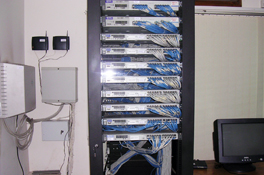
High-End Server

Information management embraces all the generic concepts of management, including the planning, organizing, structuring, processing, controlling, evaluation and reporting of information activities, all of which are needed in order to meet the needs of those with organizational roles or functions.

Research, Capacity Development and Training

Research creates knowledge and supports the development of designs and prototypes. Research, Development and Training are the important components of any project activity. Training is essential for the building of capacity and expertise in a particular field. In-house training is designed in such a way that the professional needs are fulfilled. CEGIS has a well-organized Research, Development and Training program. The R&D operations primarily focus on the development of new analytical tools, the investigation of new approaches, methodologies and applications to solve existing problems and persisting challenges. The research's favorable findings are then used in a variety of projects. Some of the tools and models developed under different projects through detailed research are:

  • River Erosion Prediction Tool
  • Community Flood Forecasting Tool
  • Data Analysis and Data Quality Assessment Tools
  • Flood Inundation Model
  • Storm Surge Model
  • Drought Assessment (DRAS) Model
  • Bay of Bengal Model for the Coastal Zone
  • Crop Simulation Model
  • Agriculture Crop Model
  • Bangladesh Metamodel
  • Eco-hydrological Model
  • Fisheries Model

Touch Table: a decision-making tool

The research and Development spectrum includes all facets from the start of fundamental research to the stage of a positive outcome.

Socio-economic and Livelihood Management

CEGIS offers integrated solutions for sustainable socio-economic and livelihood development through the people-centric approach which includes economic resources planning and management; poverty, gender and livelihood assessment; anthropological and demographic investigation; economic analyses; institutional assessment; water pricing, socio-economic impacts assessment and its management plan, etc. The following services are provided in this field:

  • Socio-economic Feasibility Assessment for Sustainable Development
  • Social Impact Assessment (SIA)
  • Baseline, Midline and End Line Socio-economic Surveys
  • Resettlement Action Plan (RAP) and/or Social Safeguard Plan (SSP)
  • Livelihood Improvement, Monitoring and Evaluation Framework
  • Occupational Health and Safety Plan
  • Community Health and Safety Plan
  • Monitoring, Impacts and Evaluation Study
  • Indigenous People Plan
  • Planning and Management of Socio-economic and Socio-cultural Resources
  • Social Mobilization and Institution Formation
  • Gender Analysis
  • Value Chain Analysis
  • Poverty and Livelihood Analysis and Modelling
  • Economic and Institutional Analysis
  • Social Mobilization and Formation of Resource-based Management Institutions

Rural Economy, Stimulating National Growth

Through creative wage and self-employment programs, rural development primarily focuses on poverty reduction, greater livelihood prospects, supply of basic utilities, and infrastructural facilities.

Policy Studies and Plan Formulation

CEGIS has been involved in the formulation and update of a number of nationally and internationally significant policy, planning and strategic documents in diverse development sectors such as water resources, agriculture, infrastructures, urban developments, environment, climate change, disaster management, water supply and sanitation or WASH, social development etc. CEGIS utilizes participatory and rigorous consultation tools engaging multi-level stakeholders from government and private sector, SWOT analysis, blended scientific and participatory approach for such policy studies, plan, act and strategy development and amendment at a national and local level. Spatial planning is another technique preferred by CEGIS. Some noteworthy policies, plans, acts, strategies and guidelines where CEGIS contributed in lead are as follows:

  • Bangladesh Delta Plan 2100
  • Formulation of National Adaptation Plan
  • Master Plan of Haor
  • Sector Action Plan on Environment and Climate Change
  • Transformative Capacity Development and Knowledge Management Plan for Climate Change Adaptation
  • Eco-friendly guidelines for infrastructure development in haor areas
  • Integrated stormwater management plan for rural and urban cities
  • City climate action plan
  • National Communications to UNFCCC
  • Nationally Determined Contributions
  • Strategy paper on SDGs, water resources planning and transboundary cooperation
  • Action Plan on Bangladesh Agriculture under Climate Change
  • Coastal Zone Policy and the Integrated Coastal Zone Management Strategies
  • National Water Management Plan
  • Climate resilient roads and infrastructures design guidelines
  • Supporting implementation of Bangladesh Water Act and Water Rule
  • National Environment Management Plan

Policy Formulation and Analysis

The Bangladesh Haor and Wetland Development Board (BHWDB) in association with CEGIS have developed a 20-year Master Plan which is being implemented on a short, medium and long-term basis.

Quality Assurance and Management

The ultimate products of CEGIS are the publication of knowledge. These products like reports, documents, and any other desktop publications are developed by multidisciplinary experts who also strictly monitor the quality through a systematic process following their own guidelines. Also, CEGIS maintains ISO9001:2015 (Quality Management Standard). Some of the following activities are provided in this section:

  • Develop and update standards to establish CEGIS Brand
  • Ensure quality of publications according to own House Style
  • Maintain proper ISO for 9001:2015 (Quality Management Standard)
  • Monitoring quality control aligning to the company's standard
  • Introduce neo-technologies regarding report template and creative design
  • Report review by the Expert Review Panel (technical and linguistic)
  • Monitoring the whole process to bring out quality products
  • Operating a resourceful library to disseminate knowledge
  • Publishing quarterly newsletter
  • Develop and update of company’s website
  • Making documentaries

Ensure Quality First

Produce and maintain quality documents, reports, newsletters, booklet etc.

Health and Sanitation

Bangladesh aims to achieve 100% coverage of safely managed water supply and 80% safely managed sanitation including hand hygiene facilities by 2030. CEGIS has carried out studies using geospatial technology to ensure universal access to sanitation and hygiene to accelerate progress towards achieving the SDG targets for WASH. The following service area of CEGIS covers sanitation and health condition of the country:

  • Monitoring of school water supply and sanitation (WATSAN) Facilities in Bangladesh
  • Climate Change Vulnerability of Drinking Water Supply infrastructure in Coastal Areas of Bangladesh
  • Wash Baseline survey in Bhaluka and Mirpur to access the current WASH services to the LIC and Garments workers
  • Logging of well locations, preparation of maps and design of national approach to GPS/GIS for arsenic affected areas
  • GIS-Based Management Information System for the Emergency WASH Cluster of UNICEF in Bangladesh
  • Technical Improvement Plan for the Dhaka Water Supply and Sewerage Authority Assistance to Prepare a Low-Income Customers Service
  • Identifying the climate change impact on water supply and sanitation in the WASH coverage hotspots in Bangladesh
  • Development of Arsenic Decision Support System(ADSS) for identifying Arsenic vulnerability and mitigation
  • Assessment of the impact of climate change on sanitation and health
  • Identification of Perennial Surface Water Sources for developing alternate safe water options in a high arsenic-prone area.
  • Enabling GIS-based MIS for emergency health care services of mother and child.

Ensure Pure Drinking Water

Efforts to enhance health and nutrition go hand in hand with ensuring access to clean water, proper sanitation, and decent hygiene. Communities are healthier and more resilient when they have access to clean water.

Agriculture, Fisheries and Livestock

The agricultural and Fisheries Division of CEGIS provides services in the planning and managing of agricultural resources, including crop, soil, irrigation, fisheries and livestock. It researches crop and fish modeling, drought assessment and management, food security, value chain, baseline, monitoring, impact evaluation & assessment, crop suitability assessment, climate change impact & greenhouse gas assessment. It also prepares mitigation and adaptation plans for the agricultural sector. Some of the services in this field are:

  • Crop Modelling
  • Master Plan for Agricultural Development
  • Adaptive Crop Agriculture Including Innovative Farming Practices
  • Inventory of irrigation equipment and development of decision-making software for minor irrigation planning
  • Develop numbers of Soil and Land Resource Information Systems
  • Feasibility study of Minor Irrigation, Livestock and Diary development
  • Climate Change Risk Assessment and Participatory Scenario Development for Agriculture and Fisheries Sector
  • Drought Vulnerability Assessment and Management
  • Baseline and Endline Survey of Irrigation, Fisheries and Livestock Development Project
  • Assess GHG emission from Agricultural sector
  • Climate Change and Environmental Impact Assessment on Agriculture, Fisheries and Livestock

Water Resource Management

CEGIS has extensive experience in providing intellectual services for water resource management using state-of-the-art tools, water modeling, hydro-meteorological analysis and RS-GIS-based planning tools with water resources planning and assessment and techniques for both national and international arenas. Some of the services in this field are:

  • Feasibility Study for Developing River ports
  • Environmental Impact Assessment(EIA) for eco-friendly management and conservation of natural resources
  • Integrated water resources assessment and management
  • Water resources planning and management
  • Water supply and demand assessment
  • Water quality monitoring
  • Mitigate water logging problem using hydrological modeling and techniques

Teesta Barrage

The construction of barrage is a way of river impoundments where changes in the fluvial regime of the downstream portion of the barrage undoubtedly change and the environmental setup in terms of ground condition as well as land use characteristics also experience changes.